Following a decission by the BSHC the workgroup has been disbanded and the effort is instead to focus on the work performed within EMODNET Bathymetry.
The previous BSBD data portal has been taken offline due to retirement of the used infrastructure on Amazon.
The datasets can still be access below:
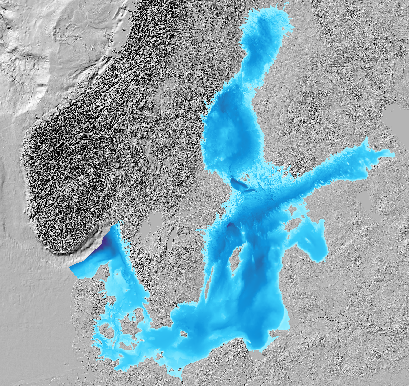
This 500m bathymetric grid model is created using data from the countries around the baltic sea. Notice that this is modeled data, not actual measurements. The purpose of this database is to deliver a homogenous bathymetric model for the complete baltic sea at specfic resolutions. It is also important to notice that this data must not be used for navigation.
To download the dataset the folowing links can be used:
BSBD 0.9.3 Bathymetry 500m grid (EPSG:3035)
32-bit GeoTIFF (app. 40MB)
BSBD 0.9.3 Density overview
Source resolution as 32-bit Geo TIFF (app. 80MB)
Source resolution as Tiff image (app. 60MB)
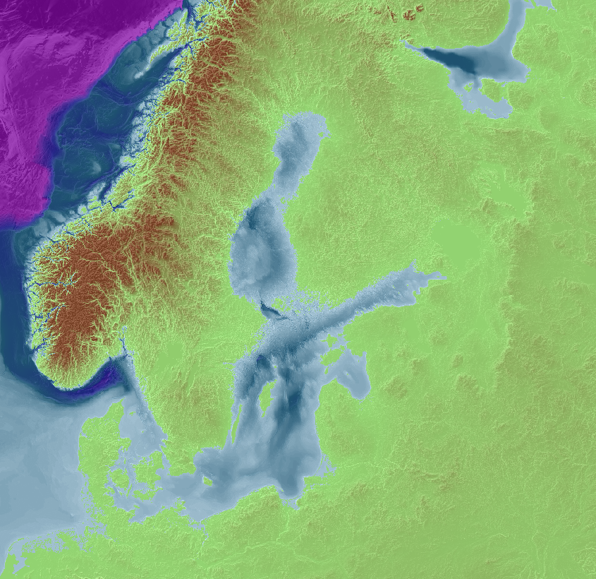
As a test we have published a WMTS service of a newer DTM in 250m resolution. We call this compilation BSBD 0.9.6 and it contains newer data than the previous 0.9.3 500m DTM in many areas. For the areas outside of the Kategatt area (app. Long 7E) all bathymetry used is from the GEBCO dataset. For elevations on land the NASA SRTM dataset has been used.
The BSBD 0.9.6 WMTS can be accessed using the link: https://tiles.arcgis.com/tiles/fD3OPY2xG762jQs8/arcgis/rest/services/BSSBDtest/MapServer/WMTS for use in your own GIS, or by the use of ArcGIS-Online directly via Map viewer (test)
For download of this DTM please use the following link BSBD_0.9.6_250m
The download is a zipped file containing the DTM in 32bit Geotiff format. Geodetic reference frame is ETRS89-LAEA (EPSG:3035). The size of the download is app. 175 MB.
Terms and Conditions
License
The Baltic Sea Bathymetry Database by the Baltic Sea Hydrographic Commission is licensed under a Creative Commons Attribution 3.0 Unported License . Additional restrictions apply.

Human-readable summary of the Legal Code
You are free:
* to Share – to copy, distribute and transmit the work
* to Remix – to adapt the work
* to make commercial use of the work
Under the following conditions:
* Attribution – You must attribute the work in the manner specified by the author or licensor (but not in any way that suggests that they endorse you or your use of the work). See below how to attribute the work.
With the understanding that:
* Waiver – Any of the above conditions can be waived if you get permission from the copyright holder.
* Public Domain – Where the work or any of its elements is in the public domain under applicable law, that status is in no way affected by the license.
* Other Rights – In no way are any of the following rights affected by the license:
* The author’s moral rights;
* Your fair dealing or fair use rights, or other applicable copyright exceptions and limitations;
* Rights other persons may have either in the work itself or in how the work is used, such as publicity or privacy rights.
Notice that the license applies for any reuse or distribution.
For the full license, please read: [CC BY 3.0, Legal Code](http://creativecommons.org/licenses/by/3.0/legalcode)
## Additional restrictions
The Baltic Sea Bathymetry Database (BSBD), and any data or products derived from it, **are not to be**
* used for safety of navigation purposes
* used for route planning
* used in Electronic Chart Display Systems
* used as an aid to navigaton
Attribution
When you use or re-distribute BSBD data, or products derived from it, please use the following attribution:
“Baltic Sea Hydrographic Commission, 2013, Baltic Sea Bathymetry Database version 0.9.x. Downloaded on *download date*
When including BSBD data in a web map, please put the copyright notice “© BSHC” in the map.
Contact
For any questions regarding the BSBD datasets please contact us through email: data<AT>bshc.pro
Replace <AT> whith the character @ in the adresses above
For any other question regarding BSHC please see the information on the contact page.
The response time may vary.